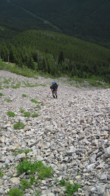
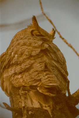
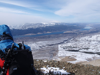
Bike/hike with Jollin... This was an outing with the Chinook outdoor club that I was coordinating. We divided into two groups - 'hikers only' and those who were interested in biking the approach up the ATV trail. Only Jollin C. was interested in joining me for the bike ride (J. brought along his infant son Tristan in a child carrier). We never caught up with the hikers, who started ahead of us from Lethbridge. We slogged our way offtrail up Maclaren's front slopes with hopes of checking out a cave that I saw last time I hiked up Maclaren, but in the end we simply made our way to the summit.
Sunday, July 18, 2010
Mt. Mclaren (July 11, 2010)
Bike/hike with Jollin... This was an outing with the Chinook outdoor club that I was coordinating. We divided into two groups - 'hikers only' and those who were interested in biking the approach up the ATV trail. Only Jollin C. was interested in joining me for the bike ride (J. brought along his infant son Tristan in a child carrier). We never caught up with the hikers, who started ahead of us from Lethbridge. We slogged our way offtrail up Maclaren's front slopes with hopes of checking out a cave that I saw last time I hiked up Maclaren, but in the end we simply made our way to the summit.
Wednesday, June 16, 2010
Mount Proctor. May 24th, 2010 (Fernie, B.C.)
Here is a little POV video I made for trailpeak.com
Kurt and Brian from trailpeak are advertising this camera line on their website and lent me a 'Drift' headcam from POV cameras to try out for a few months.
Sunday, June 13, 2010
Scenic Point Ridgewalk and a strange bear encounter
June 13th, 2010. Glacier National Park, Montana
James Y. and I spent the weekend peakbagging in Two Medicicine and did the Scenic Point ridgewalk on Sunday, as described in the climbing guidebook by J. Gordon Edwards. This traverse encompasses three minor peaks along the way and is a great early season destination.
I was a bit tired from our previous day's scramble up Never Laughs mountain and decided to bail on Scenic Point, which was a detour along the traverse. I took a break at the false summit of Scenic Point and James and I agreed to meet up again in 30 minutes. From my vantage point I could watch J.'s progress and saw that he made it to the Point in 15 minutes. When I saw him turning back to meet me, I decided to try and intersect him before the col, and expected to see him below me on the interconnecting ridge between Scenic Point and Medicine.
As I started to ascend the connecting ridge, James disappeared from my view - only for a few minutes until I got over. When I topped out on the other side, I scanned beneath me but could not see where he had gone, not realizing that he had ascended ahead of me and was further along the ridge to the south. Searching for him below, I dropped down a ways and traversed, intermittently calling out his name, side- stepping clumsily along. As I scanned beneath me for James, I thought I saw some movement off in the distance.
"Geeze, is that a rock or a bear?" I thought to myself, spotting a little brown dot off in the distance that was possibly showing signs of movement. I banged my poles together just in case it wasn't my imagination. The little dot showed some sign of reaction to the noise. Upon closer inspection, it was a grizzly sow and she had a cub with her and they were maybe a couple of kilometres away. The bears seemed quite pretty far off and didn't seem too distracted by me, still I was glad that I hadn't surprised them closer up. I hoofed it back up to the top of the ridge and as the slope flattened, they disappeared from my view. I came accross James almost immediately, and found him sitting down and rummaging through his pack, about to take a snack break.
"Didn't you say earlier on that you really wanted to see a grizzly bear today?" I foolishly asked James. I explained that the bears were a safe distance off, and lead him over to catch a glimpse of the grizzlies off in the distance.
In retrospect, the rounded ridge was not much of an obstacle to overcome, but I felt safe by the distance. Descending back towards the eastern slope, the view of the valley beneath us opened up and we spotted the bears on the slopes below. We snapped a couple of pictures as they went about their business, although the sow seemed to look directly at us at one point for several seconds. We were directly upwind and there was a light breeze blowing. After only a brief couple of moments, we decided to get out of there and continue upwards to Medicine and the long traverse ahead of us.
We hurried along and joked about the experience, taking the odd nervous glance over our shoulders as we approached the base of the rounded dome that is simply noted as 'Medicine' on my trail map.
Barely into our ascent, James caught a glimpse of the bears, now on the ridge with us, and stated simply, "S&?t! There they are!" Unsure of what to do, we pressed on with our ascent, mindful not to run, which might make us appear as prey. The bears followed our footsteps, almost as if we had left bread crumbs!
Our hearts pounded as we ascended at a good pace, putting out our fitness to the test. We also traversed as quickly as possible to get some distance between us and the bears, so really we were ascending diagonally. The grizzly and the cub covered the ground between us effortlessly, and began to run towards the base of the mountain - towards us. As the bears neared, we discussed our options - I had a bear banger in my pocket and planned to use it if the bears started up the slope after us and if they got within 50 metres. We both had bear spray and were mindful of the stiff breeze and questioned the effectiveness of spraying directly into the wind. As we traversed, the domed shape of Medicine hid the bears from our view, and we could not see more than 40-50 metres to the west of us. We hadn't stuck around long enough to see if the bears had followed us upslope or had gone down the next valley, so we were constantly glancing to west. We spotted fresh tracks in the snow in the the valley below us, and guessed that the bears had been hanging out in the valley for awhile, although there did not seem to be any source of food that we could figure out.
Topping out in record time on Medicine, we were glad to see that we had the peak to ourselves. To the south, there was a pair of tracks in the snow beneath Mount Henry, and we speculated that it may have been the bears, and that perhaps the wisest thing to do would be to turn back. Exhausted, I collapsed to have a quick bite and we nervously kept watch, myself eye-balling to the south and James to the north. Views were nice but we were almost afraid to look down Medicine's rounded slopes, lest the bears still be nearby. Finally, we decided that if the tracks ahead of us belonged to the bears, we would turn around, but if the tracks belonged to some other animal, it meant the bears were still behind us, and the safest thing would be to finish the traverse.
After our short break on Medicine we continued along the ridge towards Mt. Henry, and the mystery was immediately solved. James spotted a large grizzly a few hundred metres below us on the ridge's steep slopes. We couldn't spot the cub and almost thought it was another bear, although that made no sense, and later we did see that the cub was immediately behing her and that it had perhaps been hidden from view while nursing. We were safe at this point, as the slopes were pretty much sheer cliffs beneath us and we reached the conclusion that as strange as it had been to see the bears running towards us, that the bears had not not been stalking us and had been curious enough to follow our scent for a ways.
We put our efforts into the ascent ahead of us, and resolved to concentrate on the matters at hand - there was yet some steep scrambling, snowy slopes and miles of ground to cover between our location and Apistoki. With still so much snow, it was quite hard to say if a safe ascent of Mt. Henry was even possible.
We scared off a small herd of sheep just beneath Mt. Henry and tramped through snowy slopes as we approached the crux of the day - the arrets just beneath the summit. Gord Edwards states in the climbing guide that the arrets can be easily avoided by dropped 100 or so feet beneath the summit and following some class 3 terrain to the sunmmit, but everything gets more complicated when there is snow.
Arriving at the arrets first, I was undaunted by the exposure and prepared for some mad ninja moves to cross over. James wisely pointed out that although crossing the arrets was do-able, we were facing a likely retreat, as the steep slopes just beyond the pinnacles were snow laden. After much farting around, we managed to drop below the arrets, below a steep snow slope and climb up some easy class 2 and 3 slopes to the regular route, topping out on Henry. At one point, James crossed a snow slope that I was uncomfortable with, forcing him into a second sketchy crossing of said slope sans protection of any kind, but it all worked out.
From Mount Henry's summit, the rest of the traverse was viewable and we felt confident in our ability to route-find our way past any other possible difficulties. We carried on and had no other issues the rest of the day.
The bears descended down into the valley below us and we spotted them much later in the day as we made our way to Apistoki. Little dots off the distance - now that's the best way to view a bear in the back country!
This long ridge traverse included 3 named summits: Medicine Peak, Mt. Henry and Mt. Apistoki.
http://www.youtube.com/v/l__iWwd2Mlg&hl=en_US&fs=1
Kurt and Brian from trailpeak.com lent me a headcam for a couple of months, which they are advertising the website so I brought it along to try out (hence the youtube vid shown above). The head cam is a fun idea but you end up with a crapload of kind of boring footage, so I don't think I would reccommend one just for hiking/scrambling... more for action sports/skiing. I've flipped the camera back to Brian, so my POV videos are probably done, although it would be fun to stick it on the baby and make a fun 'day in the life' gag video for the family.
Wednesday, April 28, 2010
Thursday, April 01, 2010
Divide Mountain (April Fool's day scramble 2010)
Here are a few pictures from yesterday's April Fool's scramble (we did this hike on Mar. 28th, so I am not sure if it technically counts as the April Fool's scramble or not!)
This year, instead of dicy slopes in the Castle, SJ and I dealt with epic winds in Glacier Park. Got knocked down a few times, but never out! Finding the fire lookout still standing was a bonus.


This year, instead of dicy slopes in the Castle, SJ and I dealt with epic winds in Glacier Park. Got knocked down a few times, but never out! Finding the fire lookout still standing was a bonus.


Sunday, February 28, 2010
Flattop Mountain, Marias Pass area (Montana)
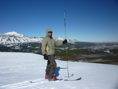
Feb. 28th, 2010. Here are some pictures from today's ski tour to Flat top in the Marias Pass area. All photos by James Y. Thanks to Ear Mountain Ralph for the suggestion awhile back! (And Dell M. and Bud I. for their advice too.)
We made our way from the parking lot at Marias Pass to the Pine creek road around 9:30 and soon turned off the road, following ski tracks into the forest towards Flattop. The tracks took us through the burn zone and eventually switchbacked up to the ridge. We continued down the ridge to the highpoint and ran into 3 snowmobilers, who were whipping about the mountains on their sleds.
We considered continuing along the ridge to Elk Calf but decided to leave it for another day… we made our way back down through the trees and were back at the cars by 3. Snow was crusty 2/3rds of the way up but we found some decent turns on the way down… we were too lame to yo-yo but twas great… hope to return again for a few laps in the snow!
Can’t believe it’s already March (mind you, usually a good month for the snow).
Sunday, October 25, 2009
Goat Moutain (Oct. 25, 2009)
SJ and I hiked up Goat Mountain this past Sunday, October 25th. There was a lot more snow than we expected but we were able to pick our way up to the summit. Starting from Sunrift gorge on the Going to the Sun road, we hiked up the Siyeh pass trail for a couple of kilometres and ascended just to the left of a big gully. The gully would be a good summer route to the top.

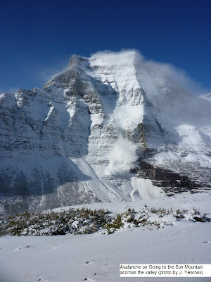
As we ascended, we heard some distant whoomphing noises that soon after were followed by a thunderous clamour from accross the valley as an avalanche poured off of Going to the Sun mountain. We re-assessed our route several times and were mindful about the avvy potential on Goat, but there was not much snow to worry about. Still, we stayed out of the gully and stuck to moderate slopes - this was also because of the snow covering everything - it would have made any hands on scrambling quite difficult.


When we got within 300 metres of the peak, our route was blocked by some cliffs/cracks that dropped off sharply below us, but we managed to carefully navigate around them. Descending we thought briefly about following the ridge south and going back more directly to the car, but to be conservative we didn't stray too far south and eventually rejoined our route form the morning.

The elevation gain was a lot more than I'd thought(4,156 ft/1266 m)! Took us a bit longer to get to the summit than planned... Guess we should've studied the map closer. My legs were just about done by the time we got to the top (El.: 8826 ft/2690 m) and my hamstrings were on the verge of cramping. The summit was truly getting blasted by the wind and blowing snow, which made it quite unpleasant, so we didn't linger too long.
A google of 'Goat Mountain' shows that at one time (back in the 1940's), there had been a trail maintained by the park all the way to the summit. The trail had been abandoned by the early 70's, as per George Ruhle's 'Guidebook to Glacier Park'.


As we ascended, we heard some distant whoomphing noises that soon after were followed by a thunderous clamour from accross the valley as an avalanche poured off of Going to the Sun mountain. We re-assessed our route several times and were mindful about the avvy potential on Goat, but there was not much snow to worry about. Still, we stayed out of the gully and stuck to moderate slopes - this was also because of the snow covering everything - it would have made any hands on scrambling quite difficult.
When we got within 300 metres of the peak, our route was blocked by some cliffs/cracks that dropped off sharply below us, but we managed to carefully navigate around them. Descending we thought briefly about following the ridge south and going back more directly to the car, but to be conservative we didn't stray too far south and eventually rejoined our route form the morning.

The elevation gain was a lot more than I'd thought(4,156 ft/1266 m)! Took us a bit longer to get to the summit than planned... Guess we should've studied the map closer. My legs were just about done by the time we got to the top (El.: 8826 ft/2690 m) and my hamstrings were on the verge of cramping. The summit was truly getting blasted by the wind and blowing snow, which made it quite unpleasant, so we didn't linger too long.
A google of 'Goat Mountain' shows that at one time (back in the 1940's), there had been a trail maintained by the park all the way to the summit. The trail had been abandoned by the early 70's, as per George Ruhle's 'Guidebook to Glacier Park'.
Subscribe to:
Posts (Atom)