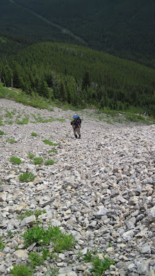
Here are a few pix from a cloudy Saturday scramble up Kishinena Peak (or as James Y. would call it, Kiss my Nina) in Waterton, Oct. 9th/2010.
James and I biked the eight km cart trail to Snowshoe cabin campground from Redrock Canyon. Since bikes are only permitted as far as Snowshoe campground, we stashed our bikes at that point and hiked up the trail to Twin Lakes. The plan was to continue along to South Kootenay Pass and follow the ridge to the summit of Kishinena. In the end, we didn't hike all the way to S. Kootenay pass, as we found an easy scramble up to the summit from the col between Bauerman and Kishinena (nothing harder than class III).
Kishinena's summit was just high enough to be sticking into the cloud ceiling, so views were obscured right at the top. Dropping down from the peak along the ridge, we were rewarded with the views we were seeking, looking west into the Flathead. We descended back via the Sage Pass hiking trail.
There was a well worn path along the ridge and I was surprised by the amount of human tracks. Kishinena must be a popular peak bagging destination for the back country campers at Twin Lakes.
The bike back to Redrock was a blast and didn't take too much effort, with gravity doing most of the work. Round trip time was 7 hours at a moderate pace with a short break at the summit and lots of photo breaks along the way.
Note: Maps show Kishinena peak located south of the highpoint (at a lower elevation... below the summit, at what appears to be a bump along the ridge just up from S. Kootenay Pass). Waterton park's summit list from GMS (Glacier Moutaineering Society) shows the elevation of Kishinena peak as that of our scramble's highpoint (7992'), as does peakfinder, so I guess that most people consider this the 'true' summit, although it is not the 'official' summit. See screenshot from GE or bivouac.com's link http://bivouac.com/MtnPg.asp?MtnId=8670
The last couple of images are of Kishenina Peak, as seen from Bauerman (taken last summer), with S. Kootenay pass circled in red in the other.
Sunday, October 10, 2010
Saturday, September 11, 2010
Dragon's Tail (Sept. 11/2010)
A few pix from Dragon's Tail on Saturday with GMS. The perfect scramble for a windy September day!
Jim F. led our group of 6 to the col between Reynold's and Dragon's Tail. From there, we followed a grassy ledge on the east side of the mountain to the far summit. A great route... See photo with Jim pointing the route out to us from afar with his hiking pole... One of those, "You want us to go WHERE?" moments.
On the ridgetop, clouds would stream up and over us and down to the valley below. Intermittent views between the clouds to the south allowed for views beyond Fusillade mountain, including Jackson glacier, as well as teasers of Sperry Glacier. Will definitely return on a clear day.
Starting at 9 AM, we hiked at a moderate pace and were back at the cars by 4 after a brief lunch at the summit.
The route we followed is described in some detail on on summit post
(click here to see SP posting.)
Saturday, August 07, 2010
Welcome to the world, Nicolas!
Sunday, July 18, 2010
Mt. Mclaren (July 11, 2010)
Bike/hike with Jollin... This was an outing with the Chinook outdoor club that I was coordinating. We divided into two groups - 'hikers only' and those who were interested in biking the approach up the ATV trail. Only Jollin C. was interested in joining me for the bike ride (J. brought along his infant son Tristan in a child carrier). We never caught up with the hikers, who started ahead of us from Lethbridge. We slogged our way offtrail up Maclaren's front slopes with hopes of checking out a cave that I saw last time I hiked up Maclaren, but in the end we simply made our way to the summit.
Wednesday, June 16, 2010
Mount Proctor. May 24th, 2010 (Fernie, B.C.)
Here is a little POV video I made for trailpeak.com
Kurt and Brian from trailpeak are advertising this camera line on their website and lent me a 'Drift' headcam from POV cameras to try out for a few months.
Sunday, June 13, 2010
Scenic Point Ridgewalk and a strange bear encounter
June 13th, 2010. Glacier National Park, Montana
James Y. and I spent the weekend peakbagging in Two Medicicine and did the Scenic Point ridgewalk on Sunday, as described in the climbing guidebook by J. Gordon Edwards. This traverse encompasses three minor peaks along the way and is a great early season destination.
I was a bit tired from our previous day's scramble up Never Laughs mountain and decided to bail on Scenic Point, which was a detour along the traverse. I took a break at the false summit of Scenic Point and James and I agreed to meet up again in 30 minutes. From my vantage point I could watch J.'s progress and saw that he made it to the Point in 15 minutes. When I saw him turning back to meet me, I decided to try and intersect him before the col, and expected to see him below me on the interconnecting ridge between Scenic Point and Medicine.
As I started to ascend the connecting ridge, James disappeared from my view - only for a few minutes until I got over. When I topped out on the other side, I scanned beneath me but could not see where he had gone, not realizing that he had ascended ahead of me and was further along the ridge to the south. Searching for him below, I dropped down a ways and traversed, intermittently calling out his name, side- stepping clumsily along. As I scanned beneath me for James, I thought I saw some movement off in the distance.
"Geeze, is that a rock or a bear?" I thought to myself, spotting a little brown dot off in the distance that was possibly showing signs of movement. I banged my poles together just in case it wasn't my imagination. The little dot showed some sign of reaction to the noise. Upon closer inspection, it was a grizzly sow and she had a cub with her and they were maybe a couple of kilometres away. The bears seemed quite pretty far off and didn't seem too distracted by me, still I was glad that I hadn't surprised them closer up. I hoofed it back up to the top of the ridge and as the slope flattened, they disappeared from my view. I came accross James almost immediately, and found him sitting down and rummaging through his pack, about to take a snack break.
"Didn't you say earlier on that you really wanted to see a grizzly bear today?" I foolishly asked James. I explained that the bears were a safe distance off, and lead him over to catch a glimpse of the grizzlies off in the distance.
In retrospect, the rounded ridge was not much of an obstacle to overcome, but I felt safe by the distance. Descending back towards the eastern slope, the view of the valley beneath us opened up and we spotted the bears on the slopes below. We snapped a couple of pictures as they went about their business, although the sow seemed to look directly at us at one point for several seconds. We were directly upwind and there was a light breeze blowing. After only a brief couple of moments, we decided to get out of there and continue upwards to Medicine and the long traverse ahead of us.
We hurried along and joked about the experience, taking the odd nervous glance over our shoulders as we approached the base of the rounded dome that is simply noted as 'Medicine' on my trail map.
Barely into our ascent, James caught a glimpse of the bears, now on the ridge with us, and stated simply, "S&?t! There they are!" Unsure of what to do, we pressed on with our ascent, mindful not to run, which might make us appear as prey. The bears followed our footsteps, almost as if we had left bread crumbs!
Our hearts pounded as we ascended at a good pace, putting out our fitness to the test. We also traversed as quickly as possible to get some distance between us and the bears, so really we were ascending diagonally. The grizzly and the cub covered the ground between us effortlessly, and began to run towards the base of the mountain - towards us. As the bears neared, we discussed our options - I had a bear banger in my pocket and planned to use it if the bears started up the slope after us and if they got within 50 metres. We both had bear spray and were mindful of the stiff breeze and questioned the effectiveness of spraying directly into the wind. As we traversed, the domed shape of Medicine hid the bears from our view, and we could not see more than 40-50 metres to the west of us. We hadn't stuck around long enough to see if the bears had followed us upslope or had gone down the next valley, so we were constantly glancing to west. We spotted fresh tracks in the snow in the the valley below us, and guessed that the bears had been hanging out in the valley for awhile, although there did not seem to be any source of food that we could figure out.
Topping out in record time on Medicine, we were glad to see that we had the peak to ourselves. To the south, there was a pair of tracks in the snow beneath Mount Henry, and we speculated that it may have been the bears, and that perhaps the wisest thing to do would be to turn back. Exhausted, I collapsed to have a quick bite and we nervously kept watch, myself eye-balling to the south and James to the north. Views were nice but we were almost afraid to look down Medicine's rounded slopes, lest the bears still be nearby. Finally, we decided that if the tracks ahead of us belonged to the bears, we would turn around, but if the tracks belonged to some other animal, it meant the bears were still behind us, and the safest thing would be to finish the traverse.
After our short break on Medicine we continued along the ridge towards Mt. Henry, and the mystery was immediately solved. James spotted a large grizzly a few hundred metres below us on the ridge's steep slopes. We couldn't spot the cub and almost thought it was another bear, although that made no sense, and later we did see that the cub was immediately behing her and that it had perhaps been hidden from view while nursing. We were safe at this point, as the slopes were pretty much sheer cliffs beneath us and we reached the conclusion that as strange as it had been to see the bears running towards us, that the bears had not not been stalking us and had been curious enough to follow our scent for a ways.
We put our efforts into the ascent ahead of us, and resolved to concentrate on the matters at hand - there was yet some steep scrambling, snowy slopes and miles of ground to cover between our location and Apistoki. With still so much snow, it was quite hard to say if a safe ascent of Mt. Henry was even possible.
We scared off a small herd of sheep just beneath Mt. Henry and tramped through snowy slopes as we approached the crux of the day - the arrets just beneath the summit. Gord Edwards states in the climbing guide that the arrets can be easily avoided by dropped 100 or so feet beneath the summit and following some class 3 terrain to the sunmmit, but everything gets more complicated when there is snow.
Arriving at the arrets first, I was undaunted by the exposure and prepared for some mad ninja moves to cross over. James wisely pointed out that although crossing the arrets was do-able, we were facing a likely retreat, as the steep slopes just beyond the pinnacles were snow laden. After much farting around, we managed to drop below the arrets, below a steep snow slope and climb up some easy class 2 and 3 slopes to the regular route, topping out on Henry. At one point, James crossed a snow slope that I was uncomfortable with, forcing him into a second sketchy crossing of said slope sans protection of any kind, but it all worked out.
From Mount Henry's summit, the rest of the traverse was viewable and we felt confident in our ability to route-find our way past any other possible difficulties. We carried on and had no other issues the rest of the day.
The bears descended down into the valley below us and we spotted them much later in the day as we made our way to Apistoki. Little dots off the distance - now that's the best way to view a bear in the back country!
This long ridge traverse included 3 named summits: Medicine Peak, Mt. Henry and Mt. Apistoki.
http://www.youtube.com/v/l__iWwd2Mlg&hl=en_US&fs=1
Kurt and Brian from trailpeak.com lent me a headcam for a couple of months, which they are advertising the website so I brought it along to try out (hence the youtube vid shown above). The head cam is a fun idea but you end up with a crapload of kind of boring footage, so I don't think I would reccommend one just for hiking/scrambling... more for action sports/skiing. I've flipped the camera back to Brian, so my POV videos are probably done, although it would be fun to stick it on the baby and make a fun 'day in the life' gag video for the family.
Wednesday, April 28, 2010
Subscribe to:
Posts (Atom)